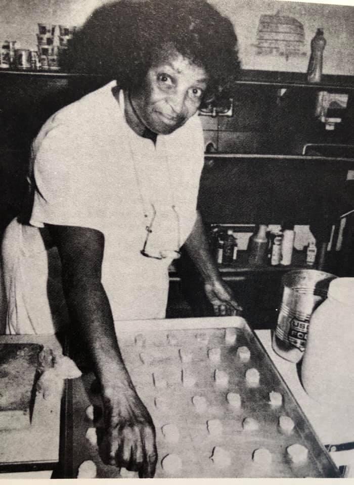
“Zenora Scott, left, worked as cook at the Waco Methodist Home for 36 years, and for over a decade she prepared meals for the hundreds of students who ate in the main dining room. When the new student center kitchen replaced the old kitchen, she moved there and continued cooking. Famed for her yeast rolls, Scott prepared them for Superintendents Johnson, Copeland, and Daniels successively, and she observed the all-white institution which had first employed her integrate first the children, then the house mothers, and finally the social workers. Of all the children whom Scott knew, she remembered Dawnyce Martin as the friendliest. ‘She would always come down from her dormitory upstairs over the dining room and visit with me. She was always a nice girl and I will never forget her.’ Photo courtesy of Methodist Home Archives.”
From the book “Centennial” (1990) by Patricia Ward Wallace.
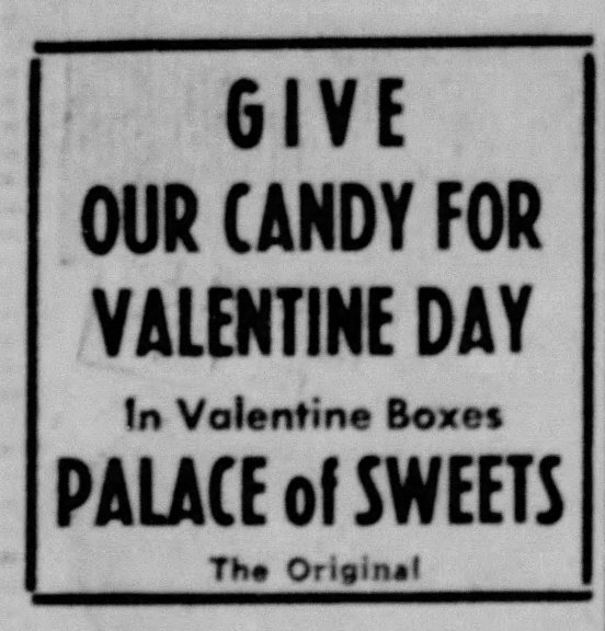
Smallest Church in the World Layman’s Time Shop 909 Columbus
According to the back of this postcard, this little building had an 8’ x 8’ sanctuary, eight seats, a pipe organ, a pulpit and a recording machine for making records. According to a a June 22, 2013 article in The Waco Tribune Herald, this church building was at another location and active in the 1930s and 1940s and the pastor was Rev. Bernie Hayter. In 1949, it was moved to 909 Columbus and became “Layman’s Time Shop”.
“Zeke Varner was one of the best friends I ever had. From the time I was 14 until he died last year, we were the best of buddies. We drank together and gambled together. Zeke played all games, from pool to poker to dominoes. He was an expert at them all. The first time I remember meeting Zeke was at the Nite Owl in West, Texas. He was always one of my biggest fans. When I played with Bud Fletcher and the Texans at the Nite Owl, Chief’s Bloody Bucket, Shadowland, The County Line, all the beer joints around Waco and West, Zeke was there every night.””
From the book “The Facts of Life” (2002) by Willie Nelson.
Willie Nelson and Zeke Varner. From the book “The Facts of Life” (2002) by Willie Nelson.
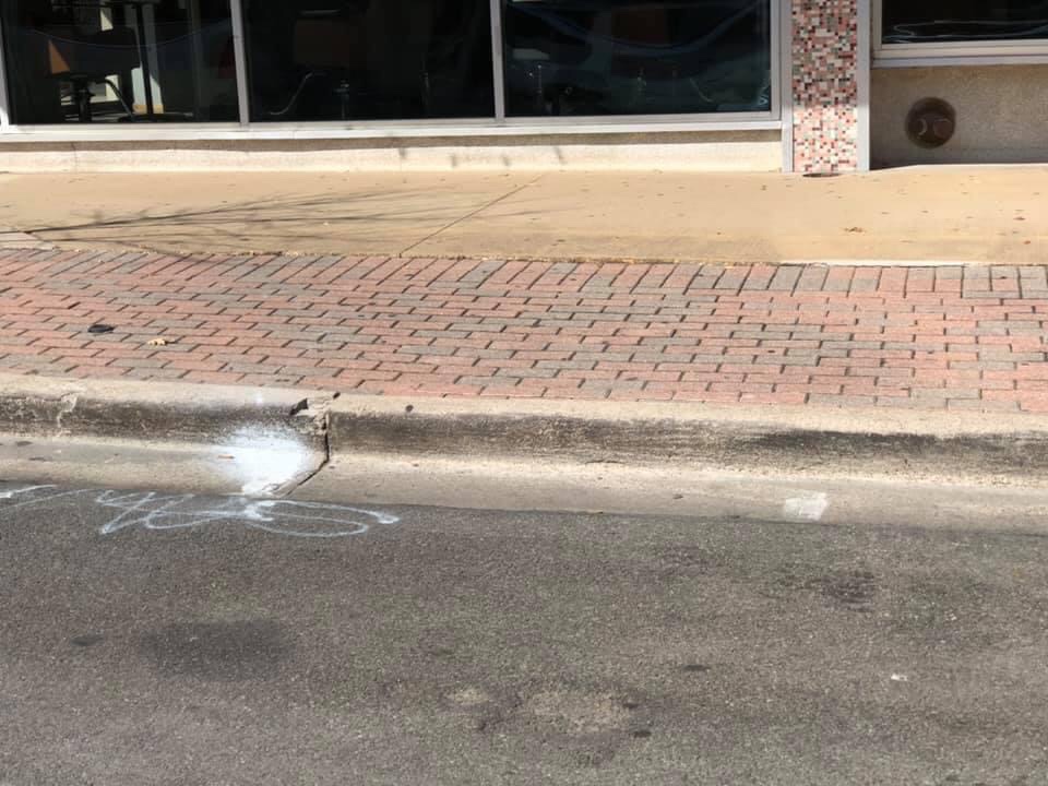
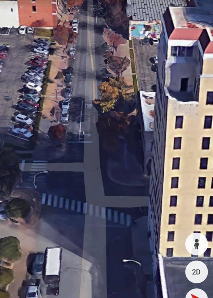
When you look at old photos of Austin Avenue, one of the first things you notice is how WIDE the street is. You usually see four lanes of traffic, with two additional parking lanes. Today, the street is much more narrow. But these present-day photos of the much-widened sidewalks let us know where the street went. These sidewalk extensions on both side of Austin Avenue, along with the trees that now line the street, really narrows Austin between Ninth and Third Steet. I believe this is a result of converting Austin Avenue back to a regular street in 1986 after the infamous Pedestrian Mall that was created in the 1970s. In the last photo, you can see that, west of Ninth Street, it’s back to the wide street that we all grew up with.
This photo highlights the original sidewalk and the brick extensions that reduced the width of the street. These are on both sides of Austin Avenue. This photo highlights the original sidewalk and the brick extensions that reduced the width of the street. These are on both sides of Austin Avenue.Photo from Google Earth.
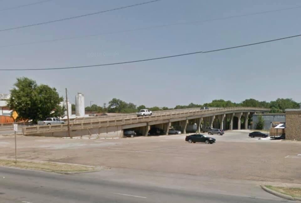
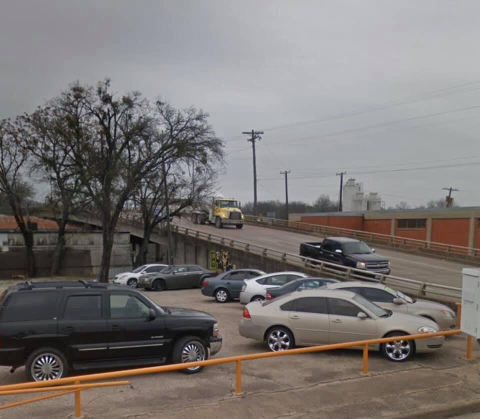
The Eighteenth Street Viaduct was completed in February, 1935. The construction of the Viaduct provided a continuous paved street from North Eighteenth and Alexander all the way out to Speight on concrete pavement, and to the highway Circle on asphalt. At the time, Fifth Street was the only other street that carried travelers across town on pavement…from Herring Avenue to LaSalle.(1) As Waco began to prepare for Interstate 35 in the early 1960s, another viaduct was built on Seventeeth Street. The new viaduct was dedicated with a ribbon-cutting ceremony on Thursday, October 11, 1962. Eighteenth and Seventeenth had become one-way at midnight the night before. (2)
(1)” New Viaduct Will Open Next Friday is Engineer Hope”. The Waco Tribune Herald, January 27, 1935. (2) “17th, 18th Are 1-Way at Midnight”. The Waco News Tribune, October 10, 1962.
The 18th Street Viaduct was completed in February, 1935. Photo from Google Earth. The 17th Street Viaduct was completed in 1962. Photo from Google Earth.
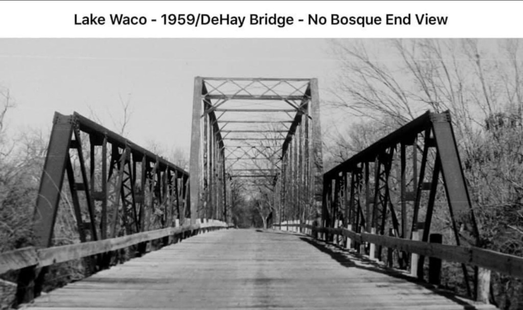
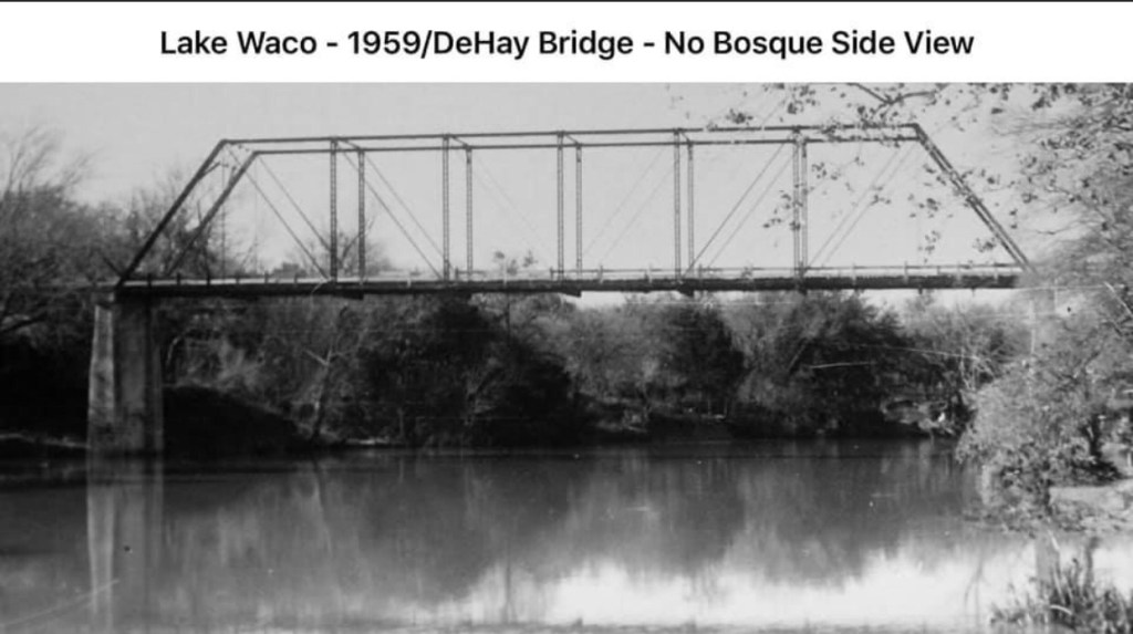
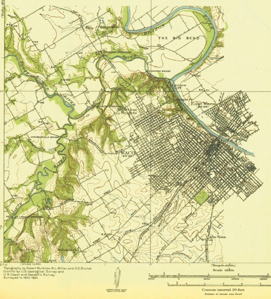
At one time, Hillcrest Drive in Waco, Texas was called “Speegleville Road”. It descended into the Bosque River Valley and led to a low-water crossing that crossed over to Speegleville. This was known as Mills Crossing because the Seth Mills Farm was on the other side of the river. Around 1900, a steel bridge with a wood plank floor was built at Mills Crossing.
When the first Waco Dam was built in 1929-30, the decision was made to move the Mills Crossing Bridge to the North Bosque. It was to be a part of a proposed 35-mile “scenic route” around the new lake. Many people who are still living remember driving over the “rickety” bridge…quite noisy as a car drove over. It was located near the DeHay Farm, and was named the DeHay Bridge. (The old Highway 6 Bridge replaced the Mills Crossing Bridge as the main bridge connecting Waco and Speegleville.)
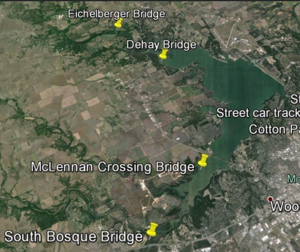
The old DeHay Bridge was removed when the new dam was built 1958-64, and a new highway and bridge were constructed linking China Spring Highway to Highway 6. CR 185, also known as North River Crossing, is just up steam from the old DeHay Bridge.
Although it’s gone, and the location is now underwater, the old bridge served Waco and Speegleville for almost 60 years, with its first 30 years at Mills Crossing and its last 30 years at DeHay’s Crossing.
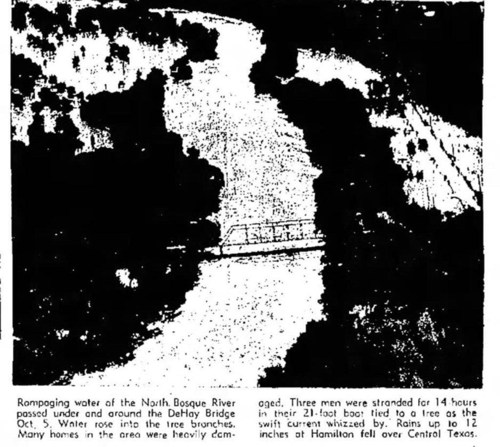
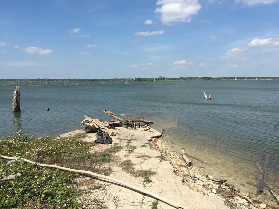
Photo courtesy of Mark Randolph/City of Waco. Photo courtesy of Mark Randolph/City of Waco.The DeHay Bridge over flood waters in 1959. From The Waco News Tribune, December 37, 1959. The photo of the flooding was from earlier in the year. This map contributed by Larry E. Jenkins shows the approximate location of the DeHay Bridge. This 1920 map, drawn before the construction of the first Lake Waco Dam in 1929-30, shows Speegleville Road, and the location of the old Speegleville Bridge at Mills Crossing shown at the left side of the photo, in the middle. This map is from our personal collection. This present-day photo was contributed by Bennett Crow, who said: “Here’s how it looks today. Under water. The road goes out to where the bridge was.”
This is an artist’s concept of the first Church in Waco Village, built by the Methodists in 1850. This is one of many church photos in our gallery “Houses of Worship”.
Photo courtesy of Meg McCarty. From the book “ Waco: A Sesquicentennial History” (1999) by Patricia Ward Wallace.
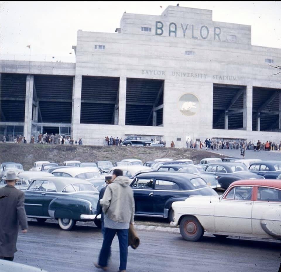
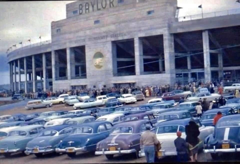
Baylor Stadium, located about four miles from Baylor on South Valley Mills Drive, was opened in 1950 with a Baylor Game against the Houston Cougars. It cost $1.8 million to build, and sat 50,000 people. At halftime of the homecoming game on November 5, 1988, it was renamed “Floyd Casey Stadium” by the son of Floyd Casey, Carl B. Casey of Dallas, who gave $5 million towards an $8 million stadium renovation project. The final game in Floyd Casey Stadium was played on December 7, 2013, against the Texas Longhorns, where the attendance record of 51, 728 was established. The stadium was used for 64 seasons before being replaced by McLane Stadium in 2014. Baylor Stadium/Floyd Casey Stadium was demolished on May 14, 2016. (Based on a Wikipedia article “Baylor Stadium”.)
Baylor Stadium November 21, 1953 Photo from http://www.hemmings.comBaylor Stadium November 21, 1953 Photo from http://www.hemmings.comBaylor Stadium November 21, 1953 Photo from http://www.hemmings.comBaylor Stadium Baylor vs. Texas A&M, 1950 Photo from The Texas Collection, Baylor University.Baylor Stadium An early photo. Construction still in progress in the end zone. A US Air Force photo. From The Texas Collection, Baylor University.Postcard from our personal collection.